95West Aerial Mapping started out in 1952 to bring the latest technology in aerial photography and mapping services to its clients. Since then, we have expanded our client base as well as kept up to date with the latest technology. We have gone from analog film photography to large format, high-definition digital imagery, and from early LiDAR systems to the latest dual channel RIEGL VQ-1560 II-S. In our continuous efforts to bring leading edge imaging and mapping to our clients, 95West recently acquired a new Cessna 208B Grand Caravan, fixed-wing aircraft to accommodate the latest equipment and added staff to process the vast amount of data for our projects.
Data Collection Systems
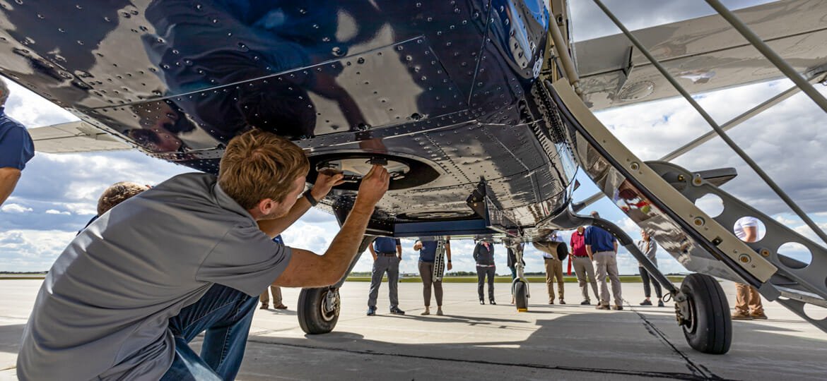
Along with the RIEGL VQ-1560 II-S LiDAR scanner, our Cessna Grand Caravan also houses a new Vexcel UltraCam Eagle M3 large format camera. With both LiDAR scanner and large format camera, 95West has the latest simultaneous collection technology. Our software has changed along with our hardware, updating, and upgrading in parallel with the newest systems. Our software, such as the Terrasolid Suite, TopoDOT, LP360, and more enhances our team’s capabilities and better integrates and aligns with our clients’ needs and industry standards.
 Why RIEGL?
95West examined several factors before choosing the RIEGL VQ-1560 II-S LiDAR scanner. The biggest consideration was the point density that a dual channel scanner can provide in a single piece of equipment. This saves space in our aircraft and helps with calibration. The VQ also fit our aircraft well, with its field of view optimized by our 3-axis gyro-stabilized mount. Having the dual channel scan density paired with our large format digital imaging also makes our projects more efficient for the client and crew, capturing data in a single flight. The data from our RIEGL scans integrate well into the formats our core clients use and prefer in their industries.
Workflow Integration
Since we updated our primary LiDAR scanner to the new RIEGL VQ-1560 II-S, all of our projects start with RIEGL. From there we have many ways we interpret, analyze, and present the data through software and systems to develop the products our clients use. The simplified calibration saves time for our team to process the data. With more automated software in our workflow, our team has more time to verify data, ensure the accuracy of our aerial mapping solutions, and create value for our clients.
Projects
Highway 8 Round About – Douglas County:
95West Aerial Mapping collected high density LiDAR and high-resolution imagery to facilitate planning, design, and construction verification for the Douglas County Highway 8 project. These flights provided bare earth LiDAR terrain data as well as orthophotos and planimetric features to accurately locate and identify roadways, ditches, structures, power lines, and vegetation for the design team. The before and after LiDAR surveys paired with sUAS imaging were valuable to the design team and to the county helping communicate with neighboring businesses and landowners throughout design and construction.
Mining Industry:
95West has a number of clients in the mining industry that employ aerial photos and LiDAR scanning to monitor their large-scale mining activities. By regularly collecting aerial photos and scanning their sites, the composite images and data assist them with long-term planning by verifying volumetric quantities, location of materials, and land reclamation projects. They can also use that same information for environmental reporting to federal, state, or local agencies.
Utility and Power Generation Industry: 
There are great opportunities for high density LiDAR scanning for the utility and power generation industry. First, our wide-angle, high-resolution camera and LiDAR scanner can cover a large area in a single scan, simplifying route planning. Before having our RIEGL VQ-1560 II-S paired with the Vexcel UltraCam Eagle M3, there were times when a planned route had to be repeated due to property easement negotiations, physical barriers, or other unforeseen conditions. A wide-angle initial scan of a large area reduces the likelihood of having to reroute or to conduct a second flight to collect information outside the initial flight path. Second, since the dual channel scanner has such great detail, the high-density data can include the power line sag, components on the poles and connections, obstructions in trees and landscape, and even environmental data. This information is invaluable for design, maintenance, structural analysis, and long-term operations of the utility lines.
Looking to the Future
We look forward to expanding our capabilities further by finding other platforms for LiDAR scanning and integrating them with others in our industry. For future transportation and highway projects we can use data fusion with terrestrial and aerial scanning or mobile scanning to get a better understanding of bridges and structures that are major parts of these systems. Future solutions like this will provide comprehensive information for our state, county, and municipal clients on the conditions of their infrastructure. With more efficient and higher density systems, we will also be able to complete bigger projects, serve larger scale clients, and expand our geographical area.


