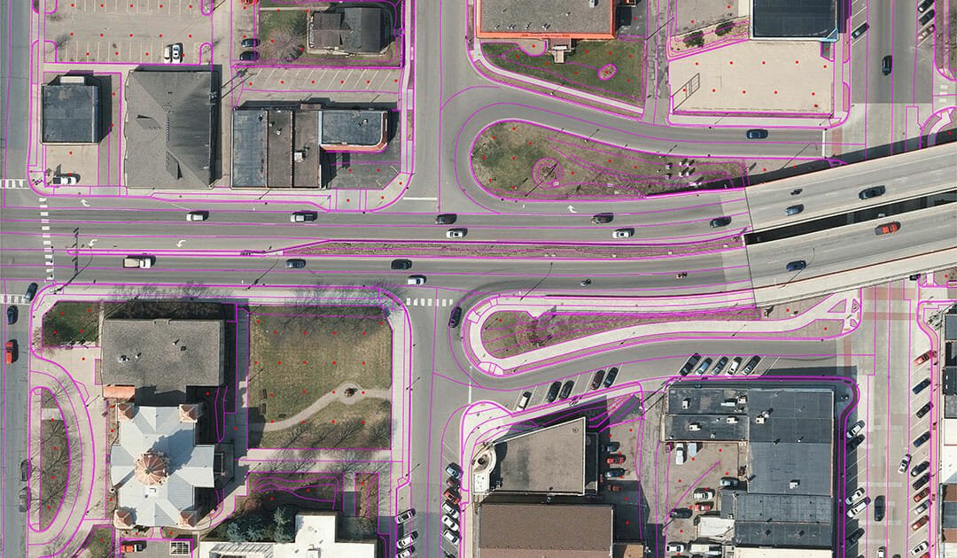
95West Aerial Mapping will talk roadway and county wide aerial mapping and lidar with North Dakota Association of County Engineers (NDACE) conference attendees this week. Stop by our booth to see how our high resolution simultaneous capture imaging and lidar system can save you time in the field and provide greater survey and mapping detail for your next county engineering project.
For more information about the conference, visit their website: NDACE – 2023 Convention
Want to learn more about how 95West’s roadway and county wide aerial mapping and lidar can be used on your county’s next project? Look for Miles Strain, the leader of the 95West’s team, at the conference or email him at Miles.Strain@95Westaerial.com. You may also contact 95West through our website contact page.


